top of page

Powering Precision with Geospatial Intelligence
Moonsate Private Limited is a forward-thinking GIS technology company that delivers end-to-end mapping, modeling, and geospatial data services to empower smarter business decisions. With a focus on accuracy, automation, and usability, we help industries visualize and manage the real world with digital precision.
Our Services
Property Mapping & Takeoffs (via Ottermap)
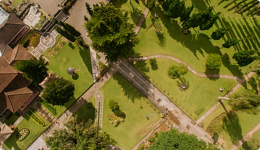
Generate ready-to-use property maps, service zones, and takeoff quantities with just an address. Perfect for snow, landscape, and property maintenance contractors. Ottermap saves hours of field work and ensures winning bids through accurate visuals and quantities.

Utility & Infrastructure Mapping
Map utility networks such as water, sewer, electrical lines, telecom cables, and street infrastructure using GIS tools and field data collection. Enable asset tracking, maintenance planning, and compliance documentation with spatial accuracy.

Environmental & Compliance Mapping
Identify and monitor ecologically sensitive areas, buffer zones, land use patterns, and pollution footprints. Our environmental GIS layers assist in regulatory submissions, EIA reports, and sustainable planning decisions.
Agriculture & Land Analysis
We offer crop zoning, NDVI health analysis, and land suitability reports based on remote sensing and historical land data. Improve yield planning, soil sustainability, and agri-advisory services with geospatial insights.
Smart Campus & Facility GIS
Digitize internal infrastructure of campuses, factories, and industrial zones — from roads and pathways to utility ducts and service buildings. Enhance operational efficiency with custom internal maps, asset layers, and planning modules.
Tourism & Heritage Mapping
Showcase heritage structures, tourism trails, and points of interest with interactive geospatial content. Create immersive experiences through 3D reconstructions, route guides, and QR-enabled mobile maps.

Disaster Planning & Risk Mapping
Prepare for natural hazards with elevation-based flood modeling, risk heatmaps, and emergency response planning. GIS mapping supports insurance evaluations, evacuation routes, and disaster recovery mapping.

Scan to BIM (Coming Soon)
Capture real-world buildings through 3D laser scanning or drone-based photogrammetry, and convert the point cloud into detailed BIM models. Useful for renovation, asset management, facility planning, and clash detection.
Ottermap — Mapping Made Easy for Service Contractors
Moonsate Private Limited is a forward-thinking GIS technology company that delivers end-to-end mapping, modeling, and geospatial data services to empower smarter business decisions. With a focus on accuracy, automation, and usability, we help industries visualize and manage the real world with digital precision.
Instantly map any property in North America
Export takeoffs and quantities
Mark service zones, entrances, and routes
Collaborate across teams
Industries We Serve
Landscaping & Facilities Maintenance
We support landscape designers, snow removal companies, and facilities managers with precise mapping tools for estimation, routing, and execution. Our solutions help businesses reduce time in the field while improving proposal accuracy and operational control.

Real Estate & Property Development
Developers and builders use our GIS services to analyze land use, zoning, development potential, and design compliance. Visual models and overlays allow informed planning and regulatory alignment before any ground is broken.
Government & Public Infrastructure
We assist municipalities and government agencies in maintaining road networks, tracking public assets, managing utilities, and planning urban expansion with high-resolution mapping and up-to-date spatial data.


Utilities & Telecom
Utility providers leverage our infrastructure mapping services to document and manage critical underground and overground assets such as pipelines, electrical lines, fiber networks, and poles, ensuring accurate records for maintenance and planning.
Agriculture & Forestry
Farmers and agri-businesses use our land analysis tools for crop zoning, irrigation planning, and NDVI-based health tracking. Forestry professionals benefit from tree cover mapping, growth analytics, and reforestation monitoring.


Environmental Compliance & Audits
We provide environmental consultants and corporations with spatial datasets and tools for environmental impact assessments (EIA), green zone mapping, waste tracking, and regulatory compliance documentation.
Construction & Renovation
Scan to BIM and site documentation services help architects, engineers, and contractors capture existing site conditions and build accurate models for retrofit, as-built validation, or design improvement.


Education Campuses & Smart Estates
Educational institutions and corporate campuses benefit from internal GIS systems that map infrastructure, manage assets, and enable navigation across large or complex sites with ease.
Tourism, Culture & Urban Planning
Tourism boards and heritage institutions use our mapping services to highlight routes, trails, landmarks, and cultural assets in interactive and immersive formats, improving accessibility and visitor engagement.


Oil & Gas
We offer geospatial solutions for the oil and gas sector, including pipeline route mapping, seismic data integration, land use compliance, and infrastructure monitoring. Accurate maps and spatial intelligence support safety, environmental management, and operational efficiency across exploration and distribution activities.
Let’s build smarter with location based insight

Moonsate Private Limited
Plot 1, Hartron Complex, Udyog Vihar phase 4, Gurgaon Email: info@moonsate.com
Terms of use
Privacy policy
Cookie policy
© Moonsate, 2025
Solutions
Ottermap Platform
Utility & Infra Mapping
Environmental GIS
Agriculture &
Land Analysis
Industries
Field Services
Real Estate & Infra
Government & Utilities
Company
Blog
Case Studies
Environment & Agriculture
bottom of page